Find's Treasure Forums

Welcome to Find's Treasure Forums, Guests!

You are viewing this forums as a guest which limits you to read only status.

Only registered members may post stories, questions, classifieds, reply to other posts, contact other members using built in messaging and use many other features found on these forums.

Why not register and join us today? It's free! (We don't share your email addresses with anyone.) We keep email addresses of our users to protect them and others from bad people posting things they shouldn't.

Click here to register!


Need Support Help?

Cannot log in?, click here to have new password emailed to you

Changed email? Forgot to update your account with new email address? Need assistance with something else?, click here to go to Find's Support Form and fill out the form.

Cool site I found for Historical Aerials

Old Navy Guy

New member
I came across this site that has been helping me find some areas to MD in.
Its called Historic Aerials

It may not show aerials photos that are very old. But for my area they go back to 1957. It has a tool that you can move a Swipe marker and compare two different years photos. It can also overlay current streets. See below...

The below photo shows mostly what the area looks like today. (well 2006)
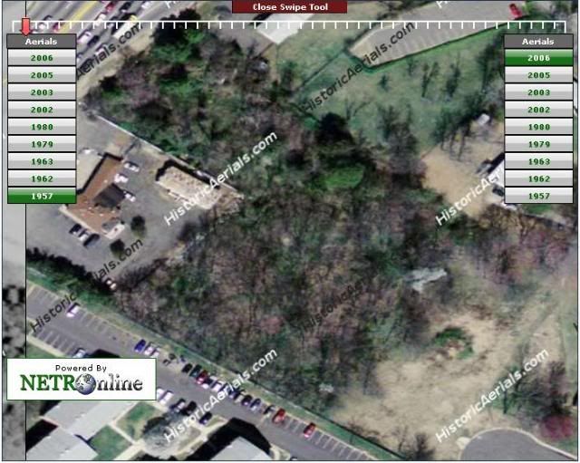
Photo3.jpg


The photo below shows you what it looked like in 1957.
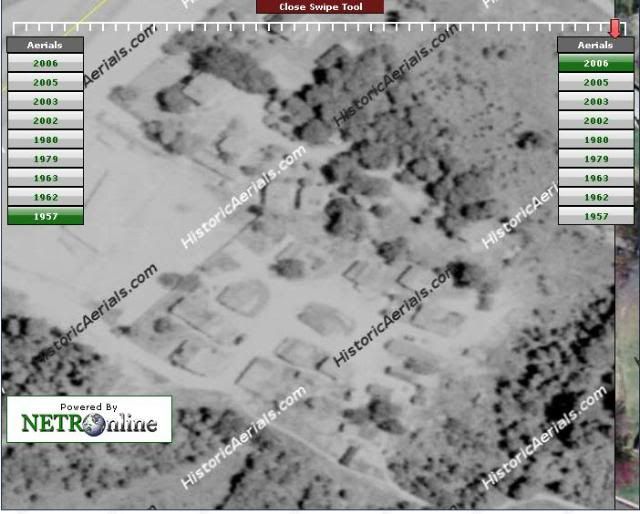
Photo1.jpg


The photo below shows the SWIPE tools in the center. This way you can see buildings and such and pinpoint them. It even as Pot LAT / LON tool but it doesn't seem to be working that well as Google earth gives different numbers on the LAT.
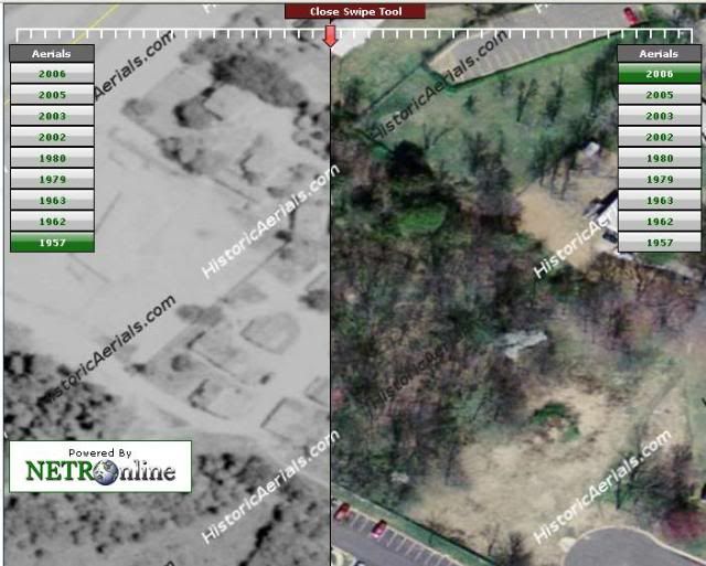
Photo2.jpg

I'm using this tool to find areas to MD and hone my skills. It is against the law in my county to MD on County Owned land. Hopefully I can get permission from some land owners to MD in the wooded areas.

I hope the above site will help others.
 
I have to say that this is the coolest Web tool I have seen in a long time that should help many of us to determine where there's a possiblity of finding older artifacts, coins, etc. I have been finding nothing but clad (a fair amount) but would love to uncover some silver coins and since there are photos of my area going back to 1957, I'll research and see what I can find in our area that seems interesting.
 
Basics on how you can use the above site.

Depending on Aerial Imagery of the area you live you might be able to see back in time.

Type in your address in the area for that in the Left upper side of your browser.

When the image loads you will see a bunch of dates on the right side. Those are the dates of Aerial Imagery available for your area. I was lucky they have Imagery from 1957 - 2006 available.

You can select Compare Tools and SWIPE then a window will load with dates on both the left and right side. A RED arrow will also load in the center top of the Image.

Once it loads you can select different dates on each side and SLIDE the Arrow from left to right to view the differences in the Images as you move the arrow.

If you go back to the main Imagery view you can select Survey Tools and PLOT LAT / LON to get exact coordinates to load in to your GPS.
 
For Maryland, you can find some old 1800's maps to use to locate old home sites and schools that may now be abandoned and use this tool and google maps or bing maps to find out if the abandoned sites are in undeveloped land. If lucky you can maybe get permission to hunt the abandoned sites.
An interactive online map for 1800's maryland is at http://www.wikitreasure.com/Maryland+USA
 
Another thanks Old Navy Guy! I'm a Newbie and my first ever MD won't be here until early next week. And now that the cold has hit I'll probably be spending most of my time in my backyard getting familiar with it. But at the same time, now is a great time to do some research and your historical aerial site is a keeper!
 
I just went to that maps site. Ended up spending the next hour looking at it. Love it, thanks for telling us about it.
I use historicmapworks.com also. This tool compliments that tool. The more tools me have the better we can do our research.
 
Top