Old Navy Guy
New member
I came across this site that has been helping me find some areas to MD in.
Its called Historic Aerials
It may not show aerials photos that are very old. But for my area they go back to 1957. It has a tool that you can move a Swipe marker and compare two different years photos. It can also overlay current streets. See below...
I'm using this tool to find areas to MD and hone my skills. It is against the law in my county to MD on County Owned land. Hopefully I can get permission from some land owners to MD in the wooded areas.
I hope the above site will help others.
Its called Historic Aerials
It may not show aerials photos that are very old. But for my area they go back to 1957. It has a tool that you can move a Swipe marker and compare two different years photos. It can also overlay current streets. See below...
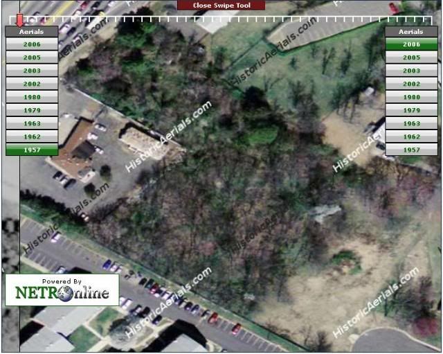
The below photo shows mostly what the area looks like today. (well 2006)
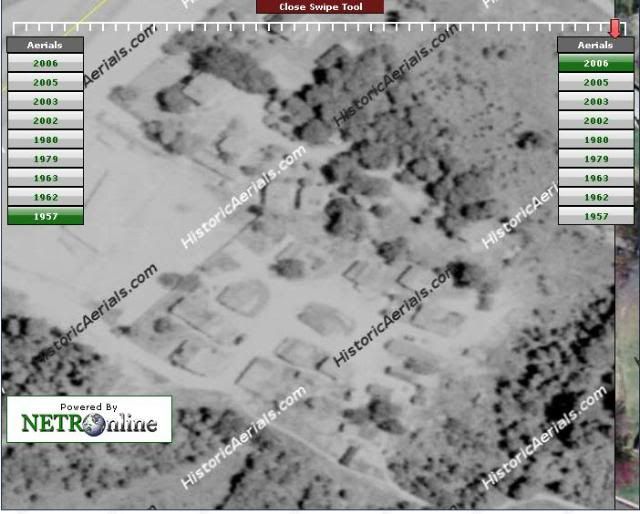
The photo below shows you what it looked like in 1957.
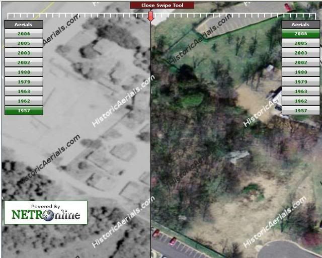
The photo below shows the SWIPE tools in the center. This way you can see buildings and such and pinpoint them. It even as Pot LAT / LON tool but it doesn't seem to be working that well as Google earth gives different numbers on the LAT.
The photo below shows you what it looked like in 1957.
The photo below shows the SWIPE tools in the center. This way you can see buildings and such and pinpoint them. It even as Pot LAT / LON tool but it doesn't seem to be working that well as Google earth gives different numbers on the LAT.
I'm using this tool to find areas to MD and hone my skills. It is against the law in my county to MD on County Owned land. Hopefully I can get permission from some land owners to MD in the wooded areas.
I hope the above site will help others.